Balancing biOdiversity coNservation with Development in Amazonian wetlandS
Where we work
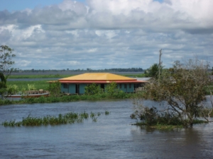 Seasonally flooded by nutrient rich waters, floodplain of “whitewater” rivers, support extremely high biodiversity and have long been centers of human settlement. Over the past several decades, unprecedented demographic and economic growths have influenced resource use and challenged capacity to sustain both humans and biodiversity on the floodplain and bordering upland. Threats to the integrity of Amazon floodplain habitats from dams, river navigation networks, extension of the agricultural frontier, and climate change are increasingly severe.
However, to date, biodiversity scenarios for the Amazon wetlands have not considered all these critical drivers.
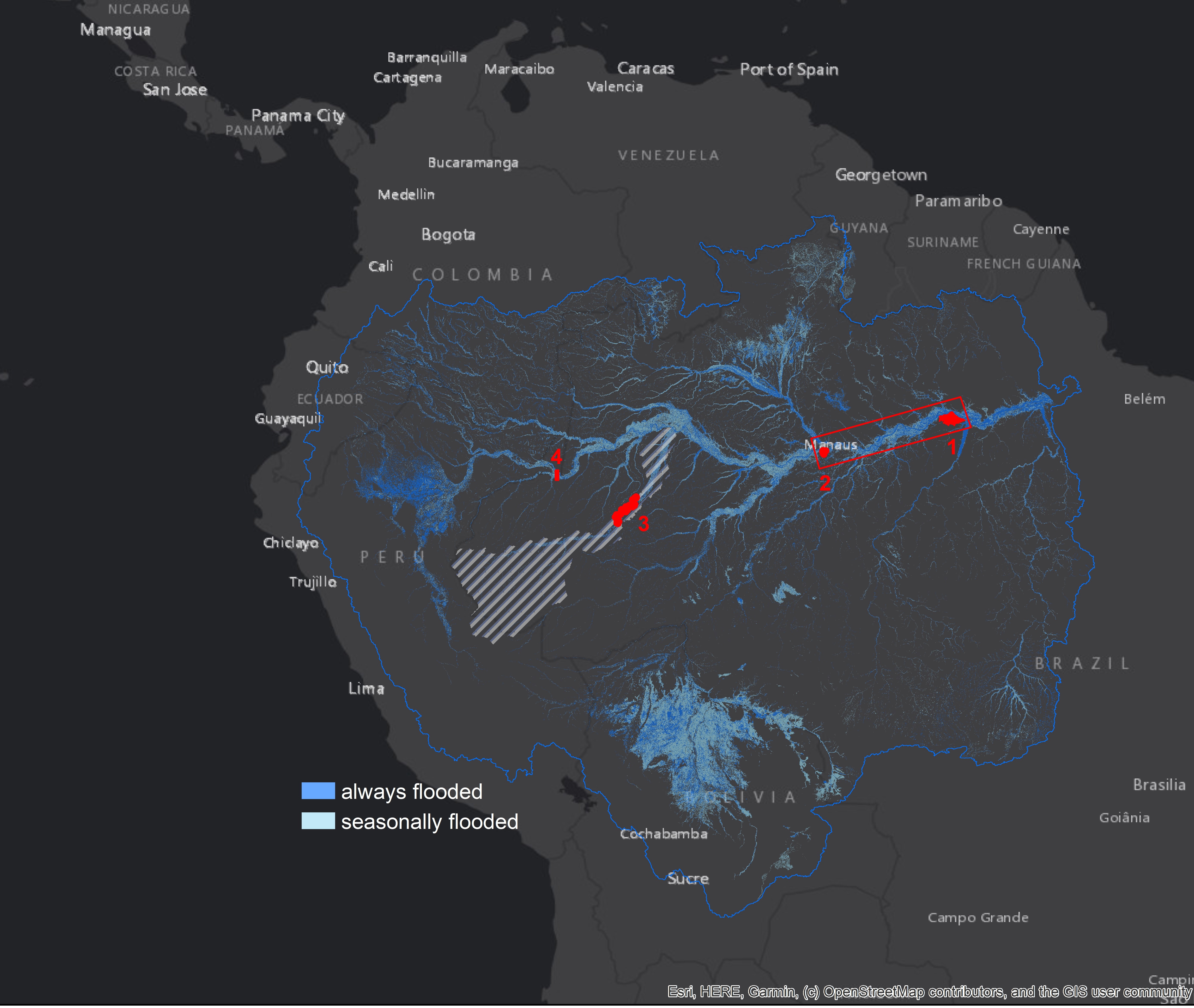
Our Study Region encompasses the floodplains of the mainstem Amazon river (Brazil and Colombia) and the Juruá river (Brazil), as well as adjacent uplands.
Click to enlarge
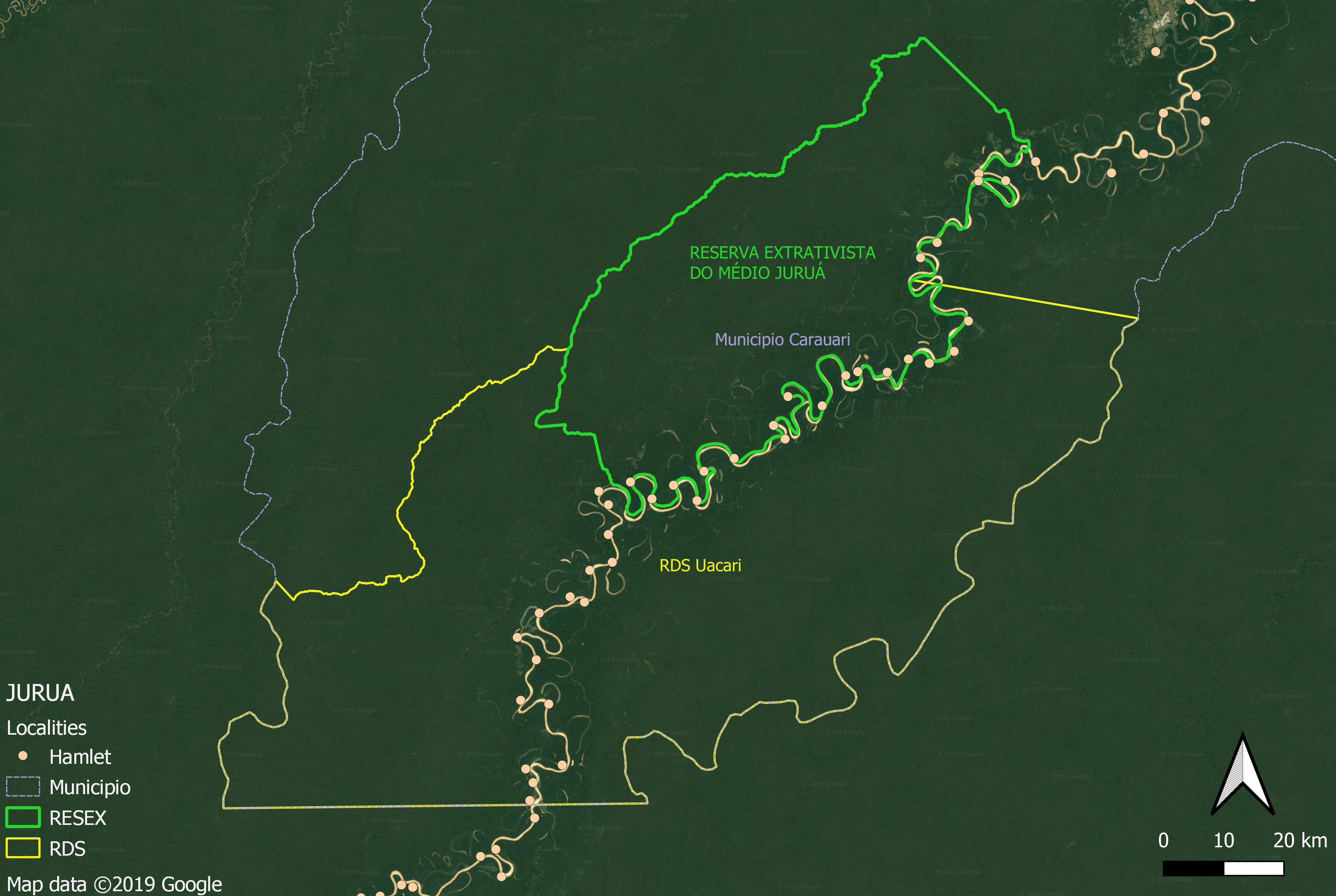
Our research framework includes four Focal Sites on the lower Amazon (Curuai and Janauacá lakes), the upper Amazon (Leticia), and the Juruá river (Médio Juruá), where consortium members have collected data for several decades on water quality, phytoplankton, forests, fish, and mammals, and have longstanding relationships with community leaders, farmers’ unions and fishing cooperatives. In addition to Focal Sites, we have identified several Auxiliary Sites along the mainstem and Juruá where habitats have previously been mapped by team members and for which more limited field data sets are available
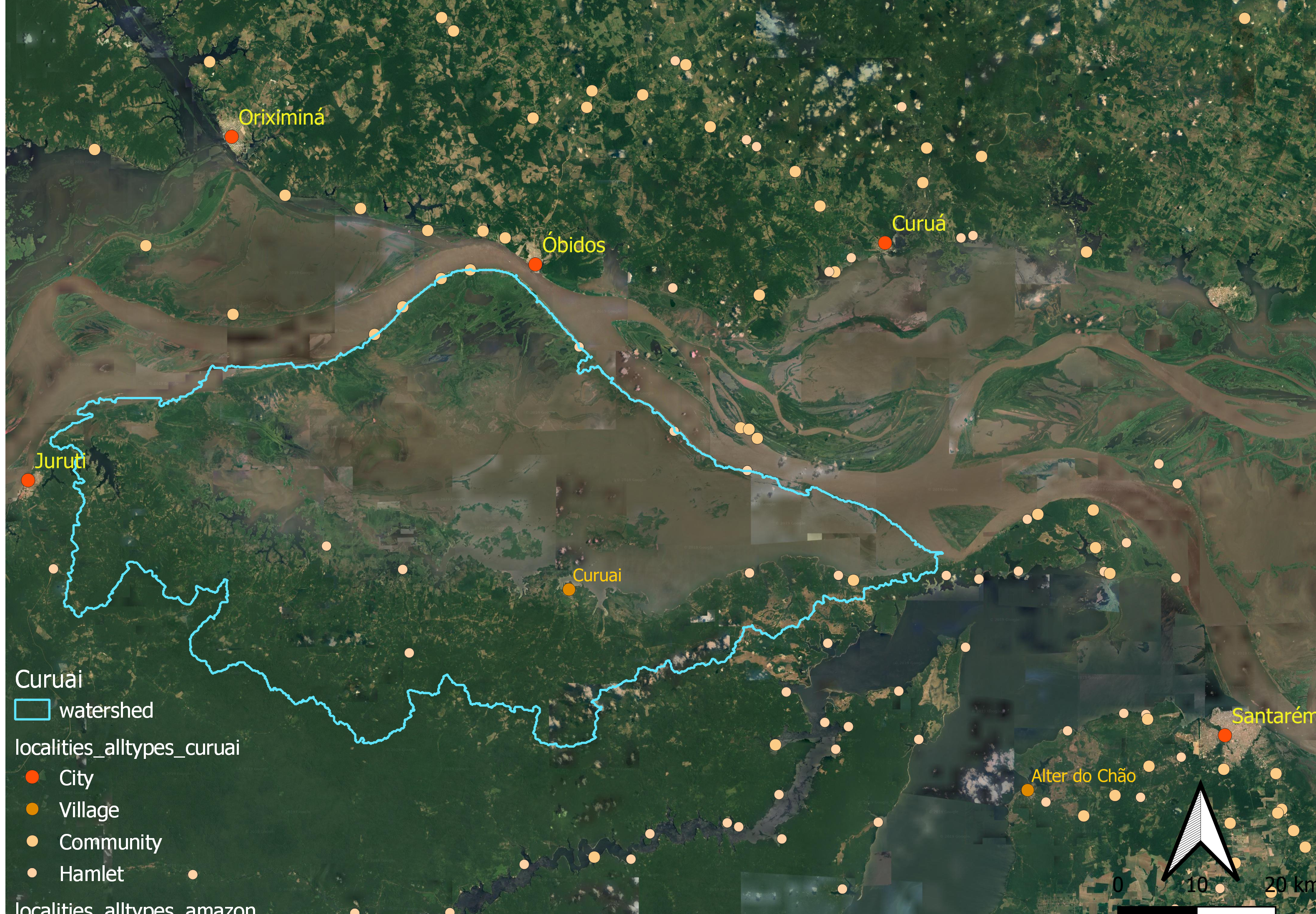
Curuai floodplain
Curuai and Janauacá lakes
Anabranching channel has resulted in scroll lakes or large dish-shaped lakes along the Amazon. The Curuai and Janauacá floodplains, lying on the southern margin of the mainstem Amazon floodplain, extend over 4500 km2 and 780 km2 (including the local drainage basin), respectively. The Curuai floodplain is composed of several intermittently connected shallow lakes separated from the mainstem by narrow levees, typical for the lower Amazon floodplain. The Janauacá floodplain is composed of a lake with fringing flooded forests and other wetlands linked to the river by a perennial channel located on the floodplain’s northeastern side. Both sites are located near urban centers (Santarém and Manaus, respectively) under rapid socioeconomic transformations that directly affect the local population’s traditional activities, who feel isolated from institutions. Both the Curuai and Janauacá sites have experienced extensive deforestation and forest degradation on both the floodplain and adjacent uplands.
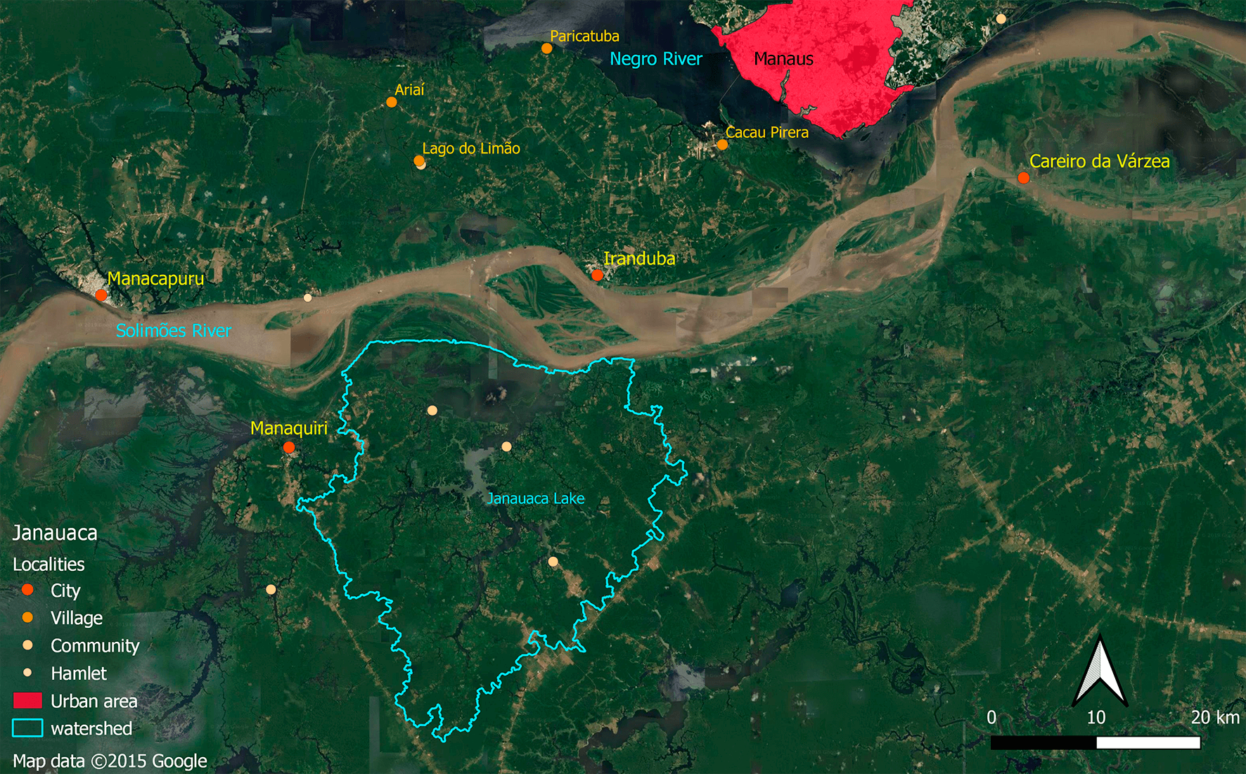
Janauacá floodplain
Juruá map
Juruá and Yauharcaca Lakes
Tortuous meandering channel has resulted in numerous oxbow lakes along the Juruá river contrasting with scroll lakes or large dish-shaped lakes along the Amazon. Both sites, are far from urban centers and highly contrast with the Janauacá and Curuai sites. The population maintains traditional activities and relationships with its environment, with little deforestation and limited or no access by road.